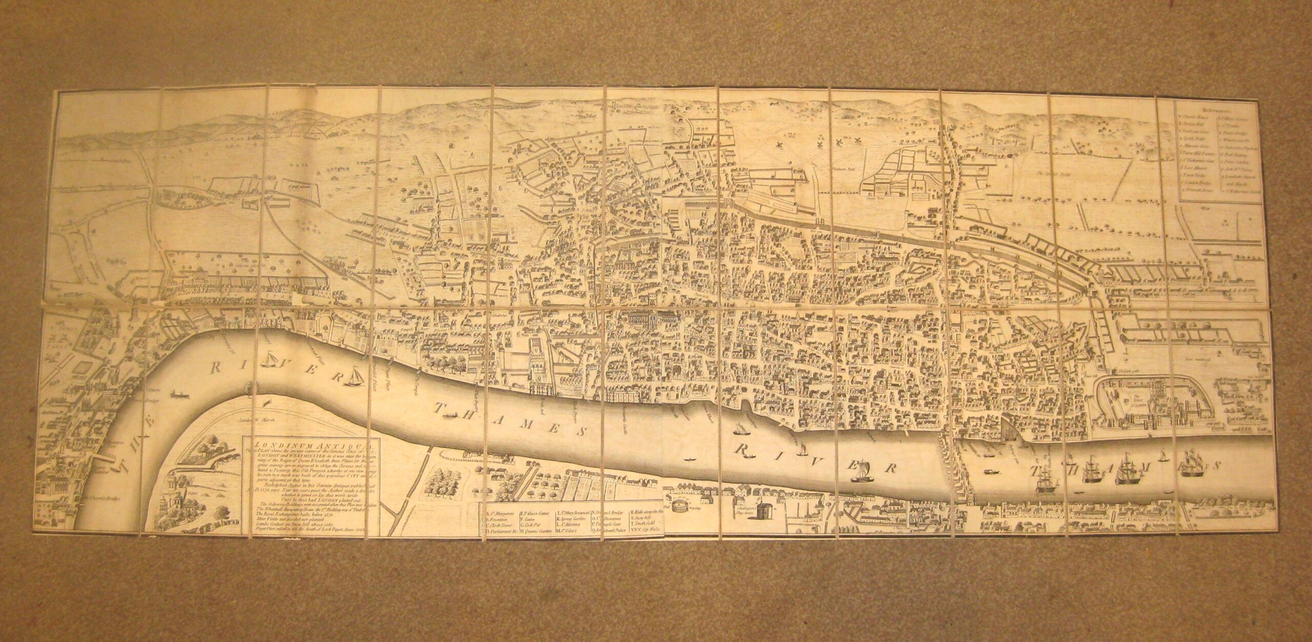
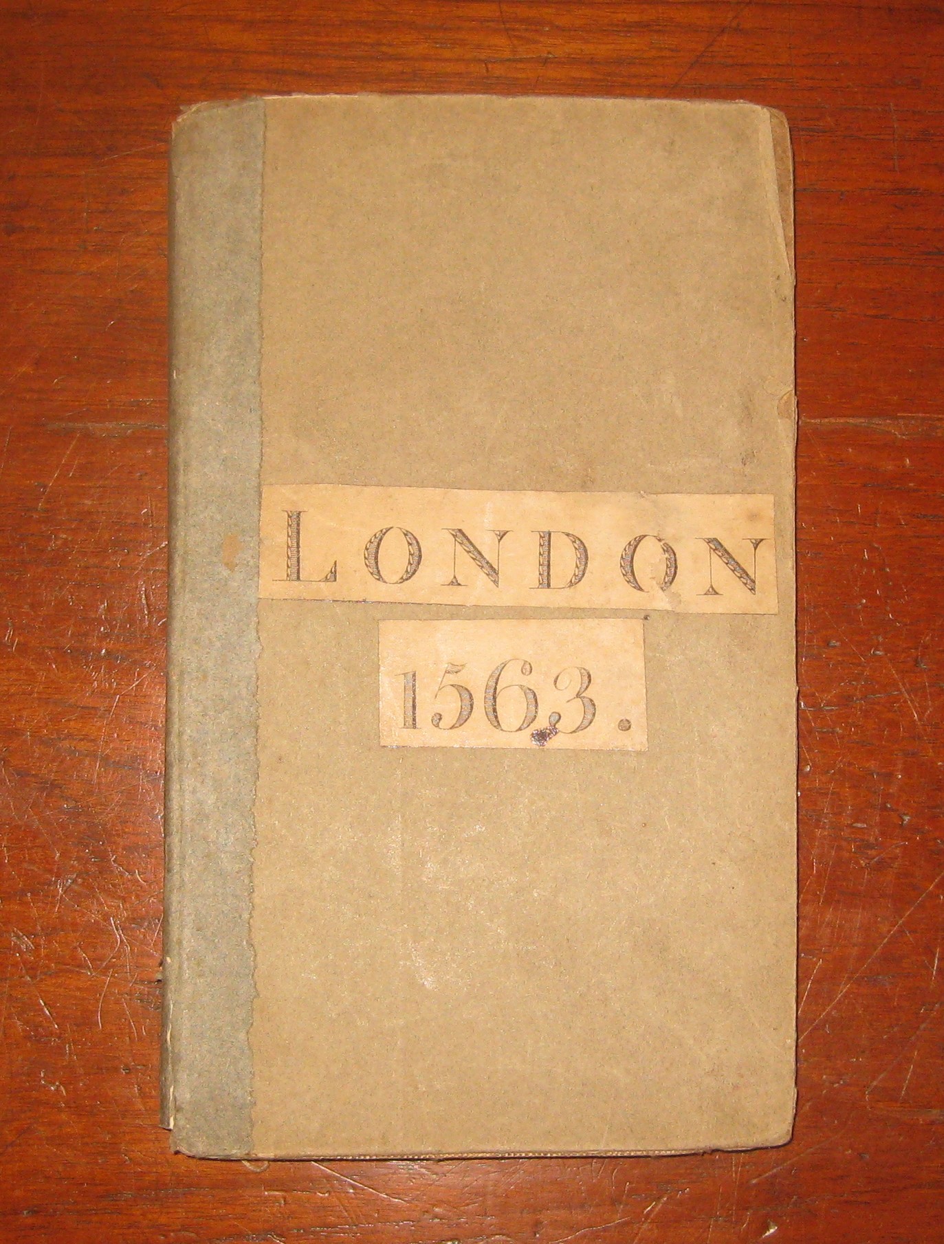
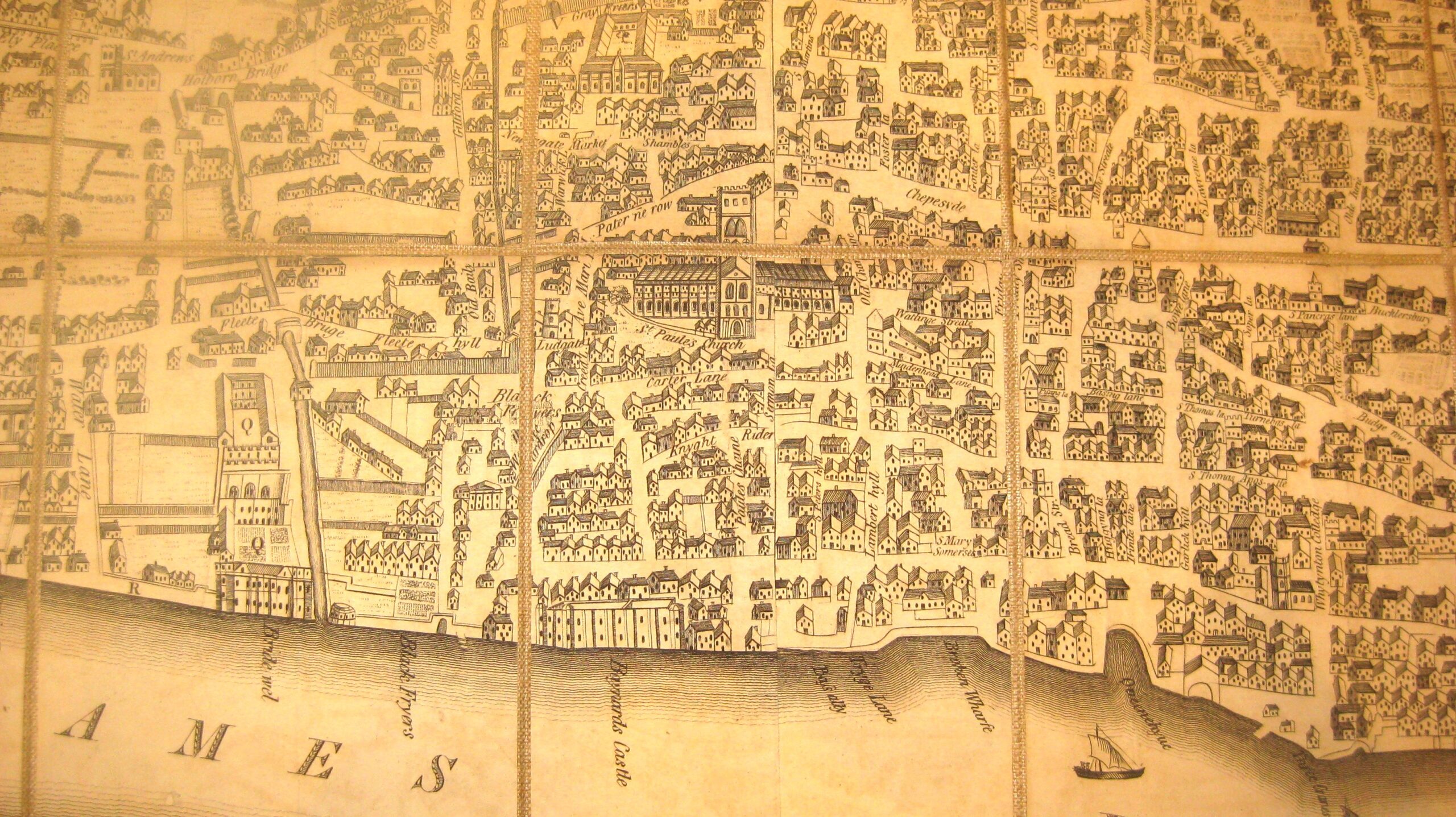
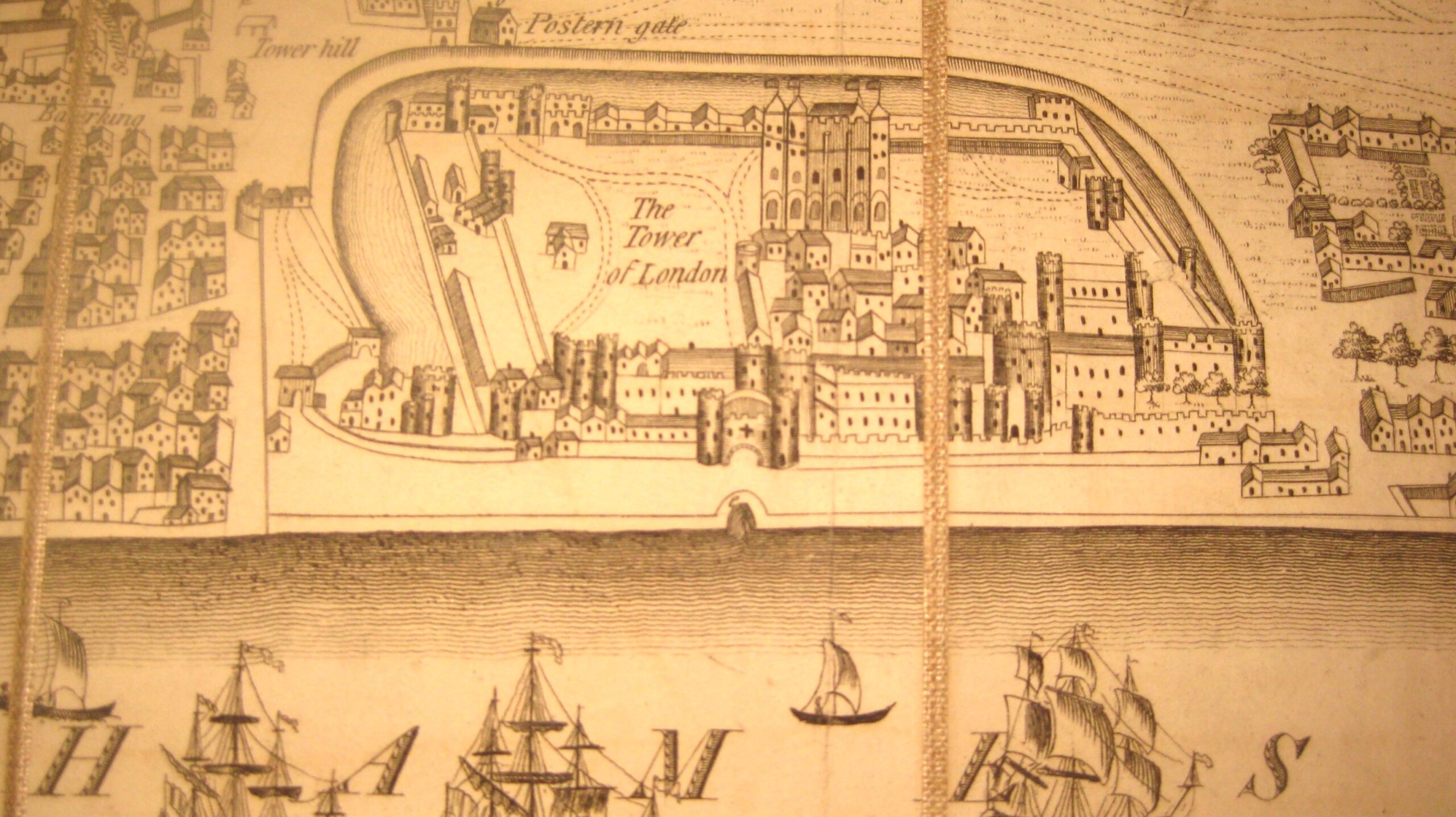
Wonderful early, 1789, map by John Wallis, London
£625
Product Description
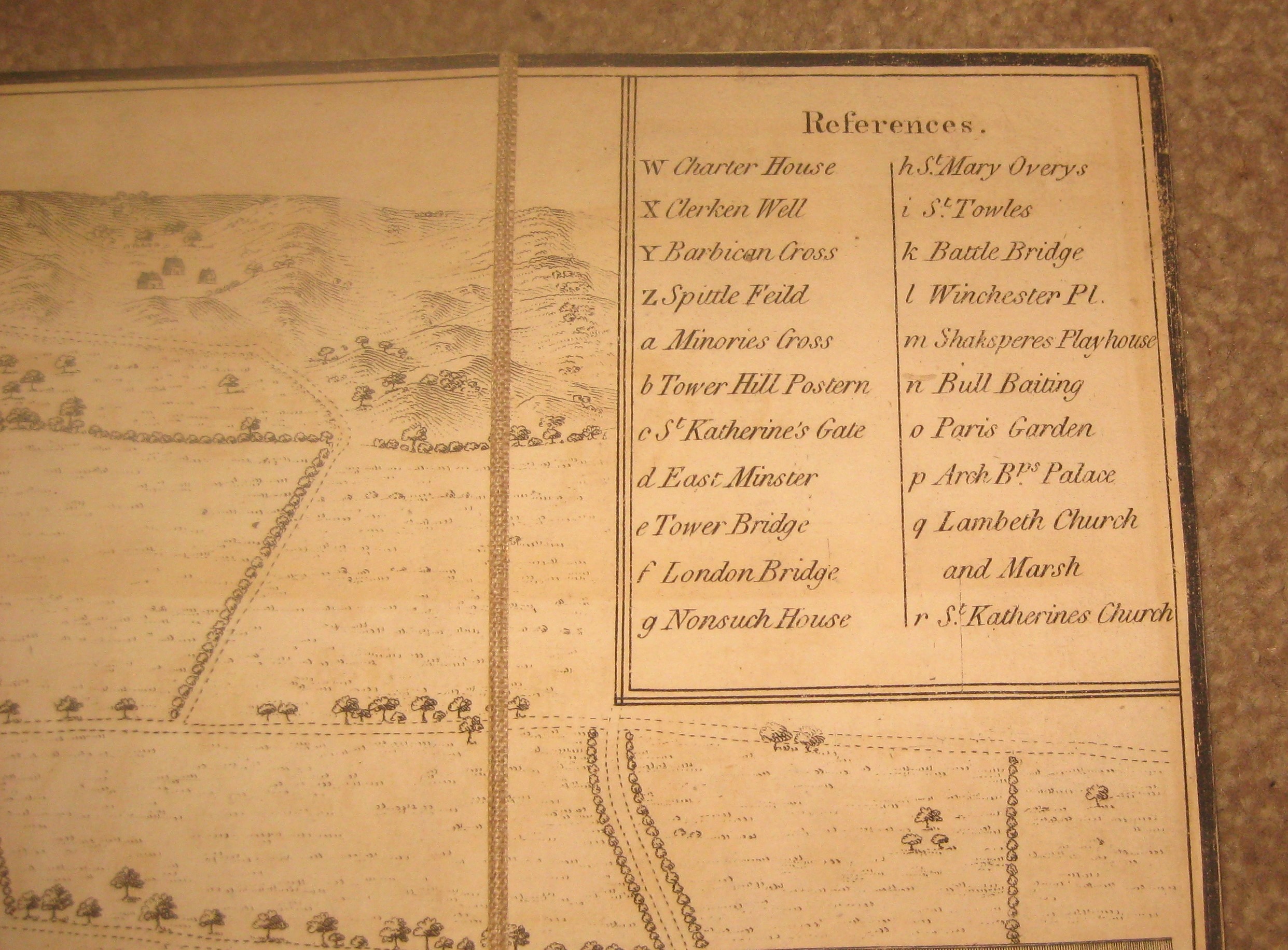
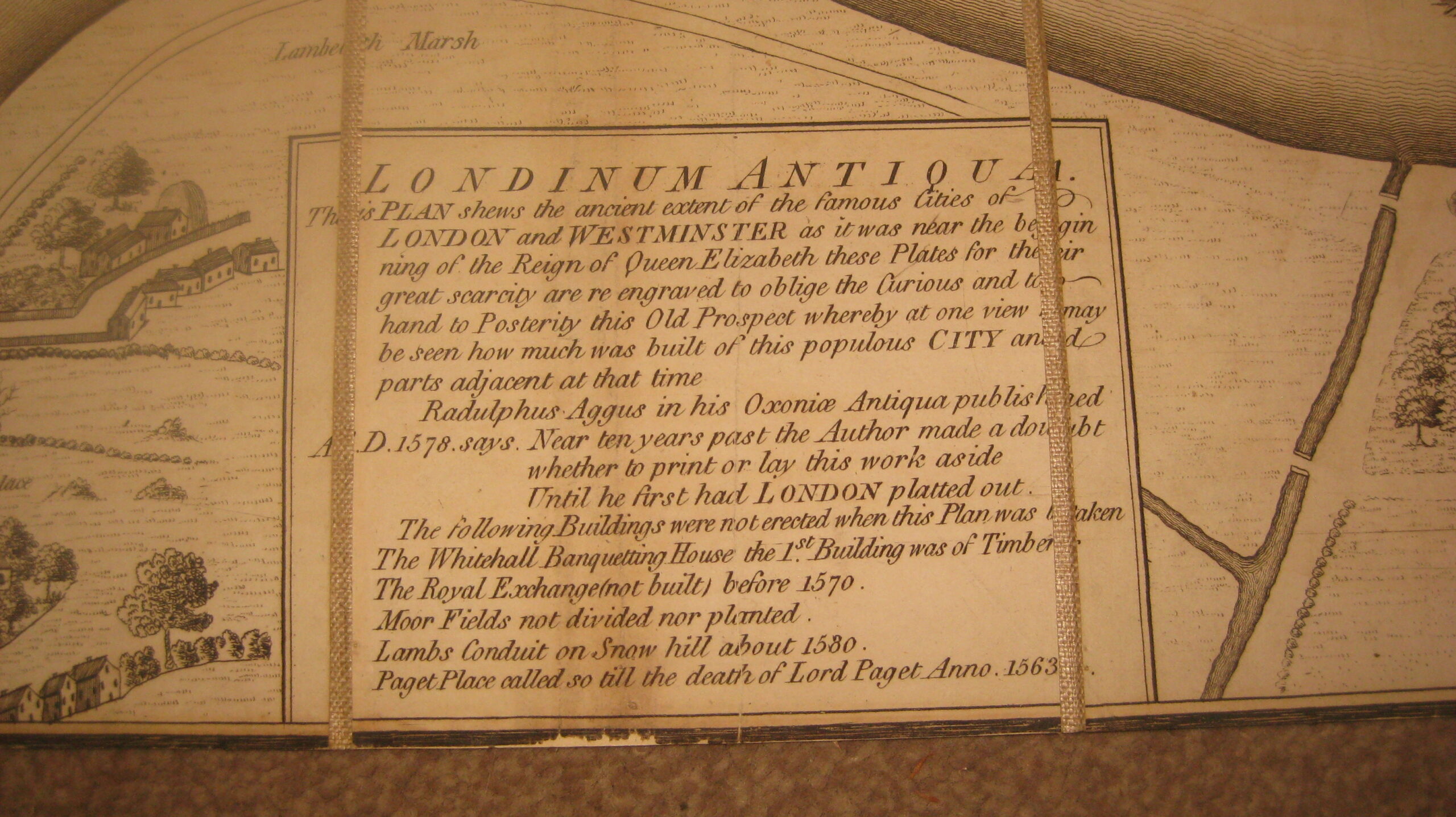
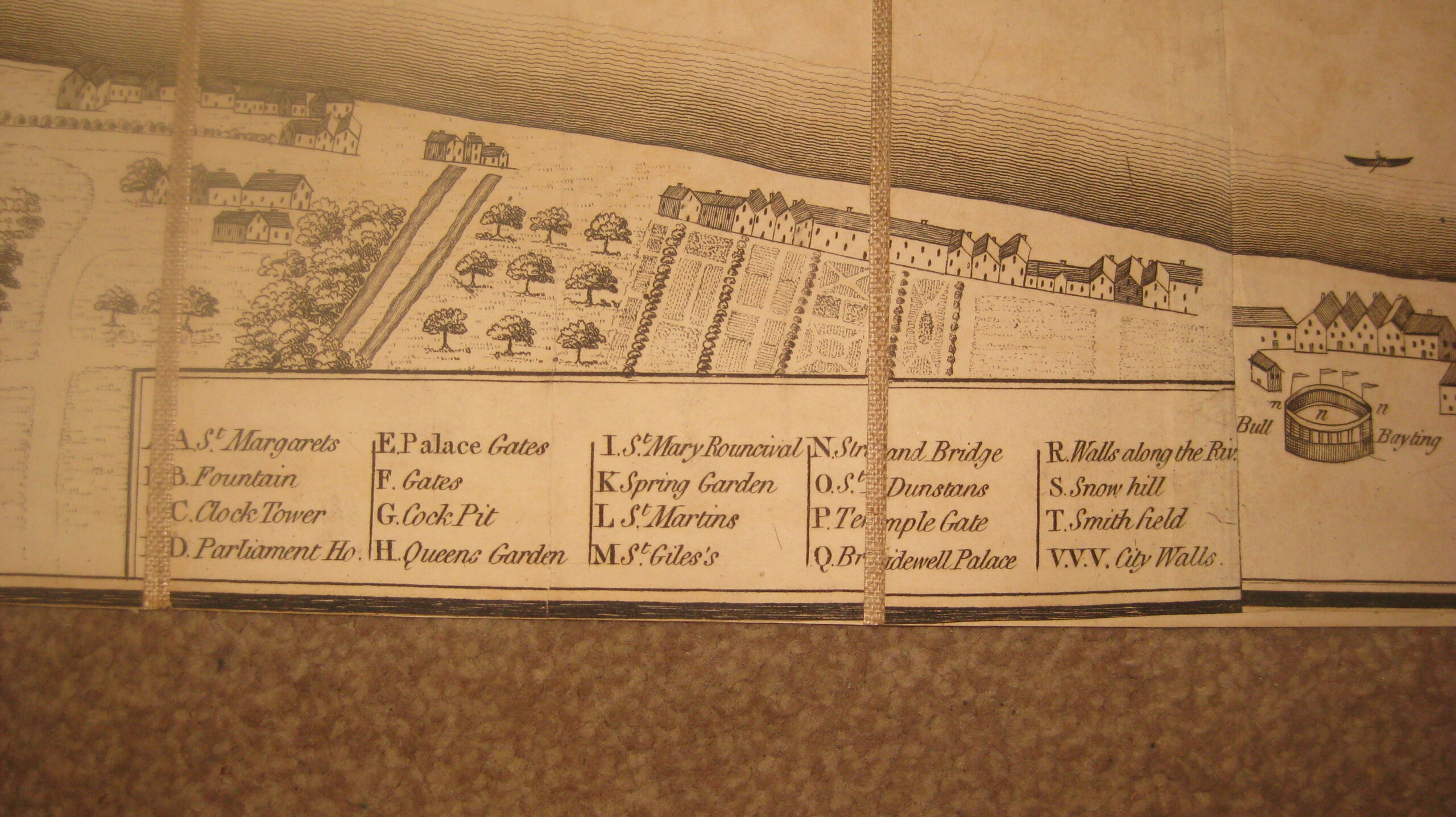
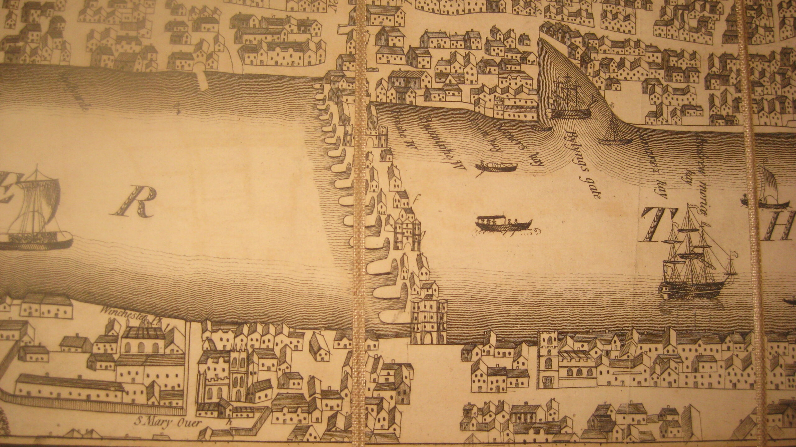
Wonderful early, 1789, map by John Wallis, London showing the river Thames. Copper engraved folding map pasted on cloth. With 2 keys to various important sites and a small cartouche with a description on Londinium Antiqua. With a loose paper cover.
Size folded 8 x 5 inches (20 x 12 cm) open 41 x 15 inches (105 x 38 cm)
Price £625
Stock no. 6270