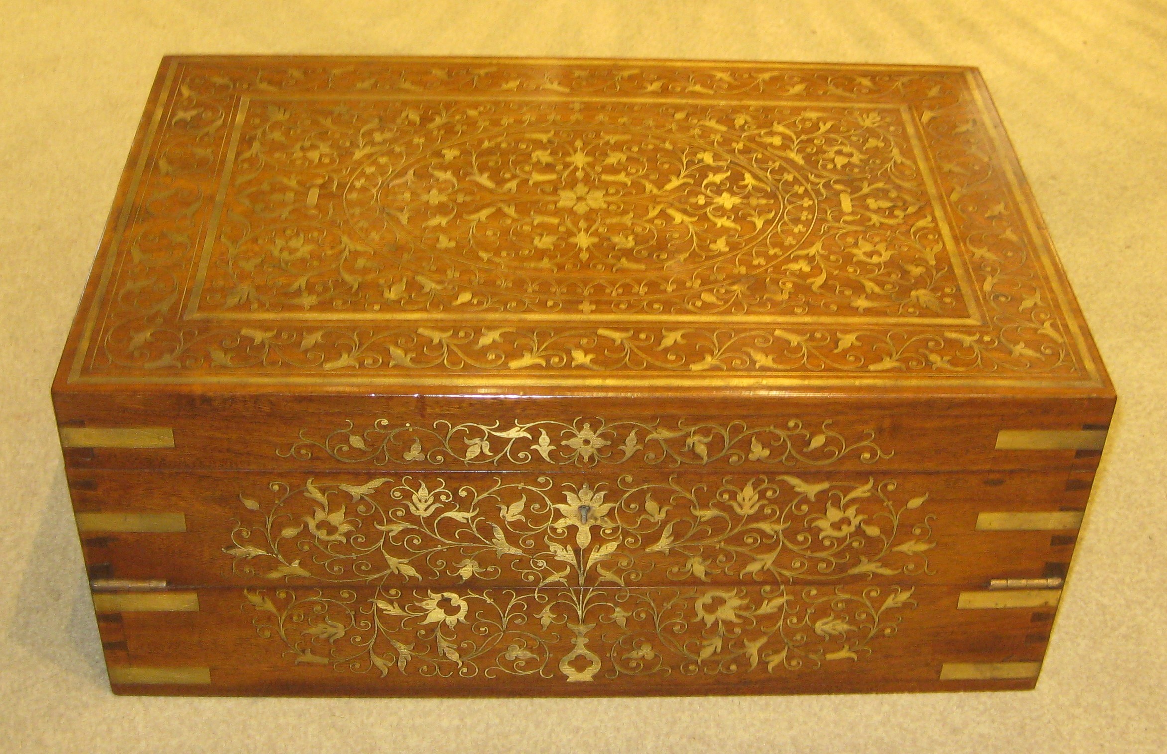
Lovely quality rosewood writing slope. With copious amounts of brass inlay, strapping and flush lifting handles. The interior with baize writing surface, secret drawers and compartments. Two of the secret drawers with an ingenious hidden release mechanism.
Size 18 x 12 x 7 inches tall (45 x 30 x 19 cm tall)
Price £545
Stock no. 6065
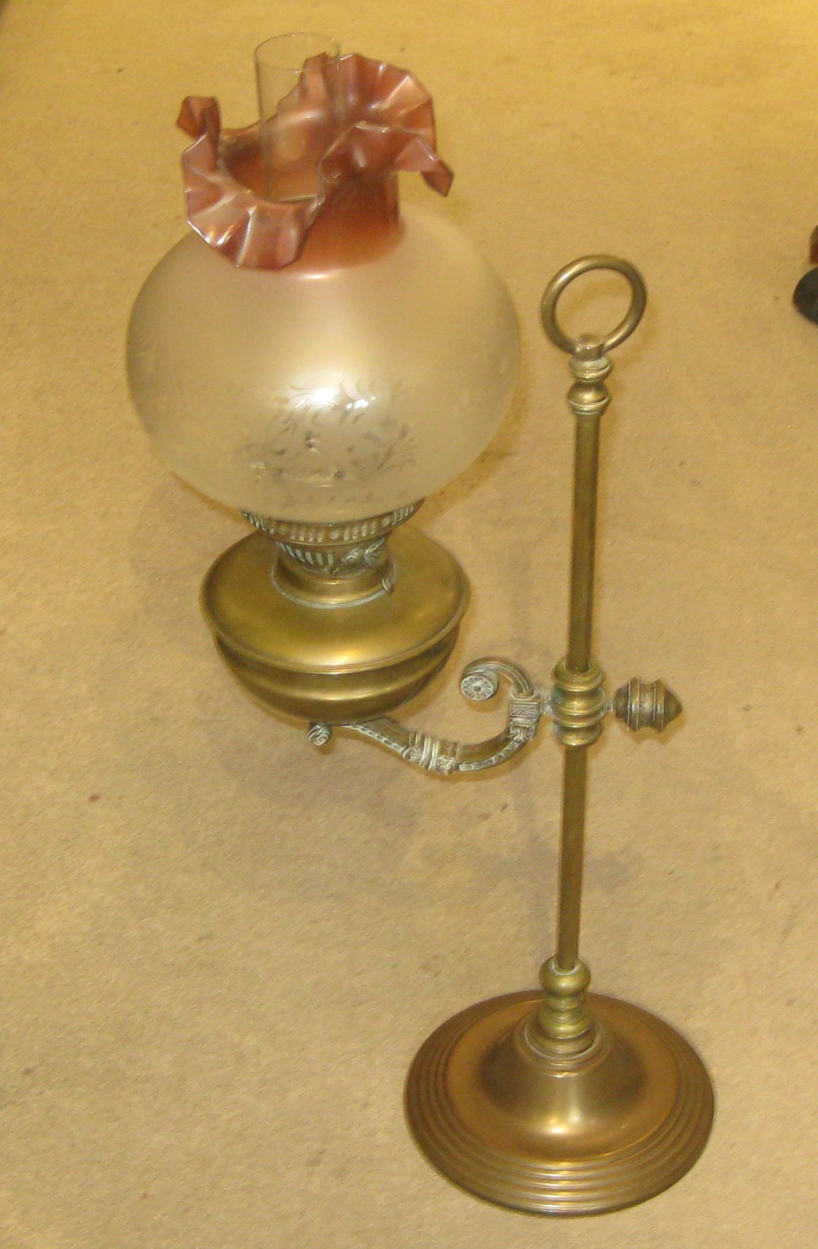
Tall oil lamp on adjustable heavy brass stand. With complete with wick, inner glass chimney and miraculously the original pretty floral glass shade.
Size 10 x 8 x 28 inches tall (26 x 20 x 70 cm tall) adjustable
Price £135
Stock no. 6066
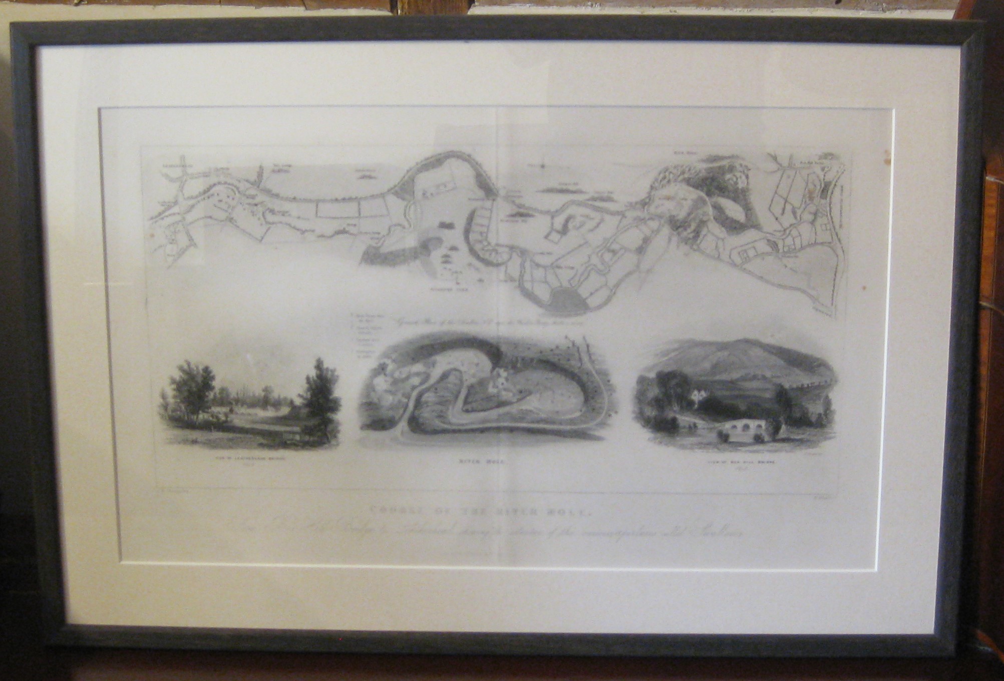
Steel engraving, ‘Course of the River Mole’ by J.R. Thompson, London, 1841. From Brayley’s ‘A topographical history of the County of Surrey’, published by Robert Best Ede. Steel engraving, folds as issued and recently framed
Titled ‘From Box Hill Bridge to Leatherhead shewing the situation of the various apertures called Swallows’
Size 21 x 14 inches (53 x 36 cm)
Stock Number 6067
Price £320
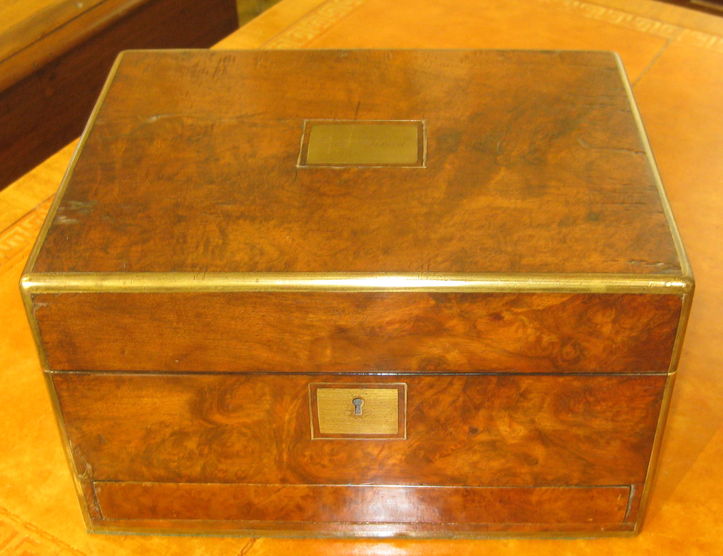
Lovely Victorian burr walnut box with protective brass edging, secret drawer and void interior awaiting lining. With engraved brass plate ‘Emily Harman’ and with working lock and key
Size 12 x 9 x 10 inches tall (30 x 22 x 18 cm tall)
Price £175
Stock no. 5832
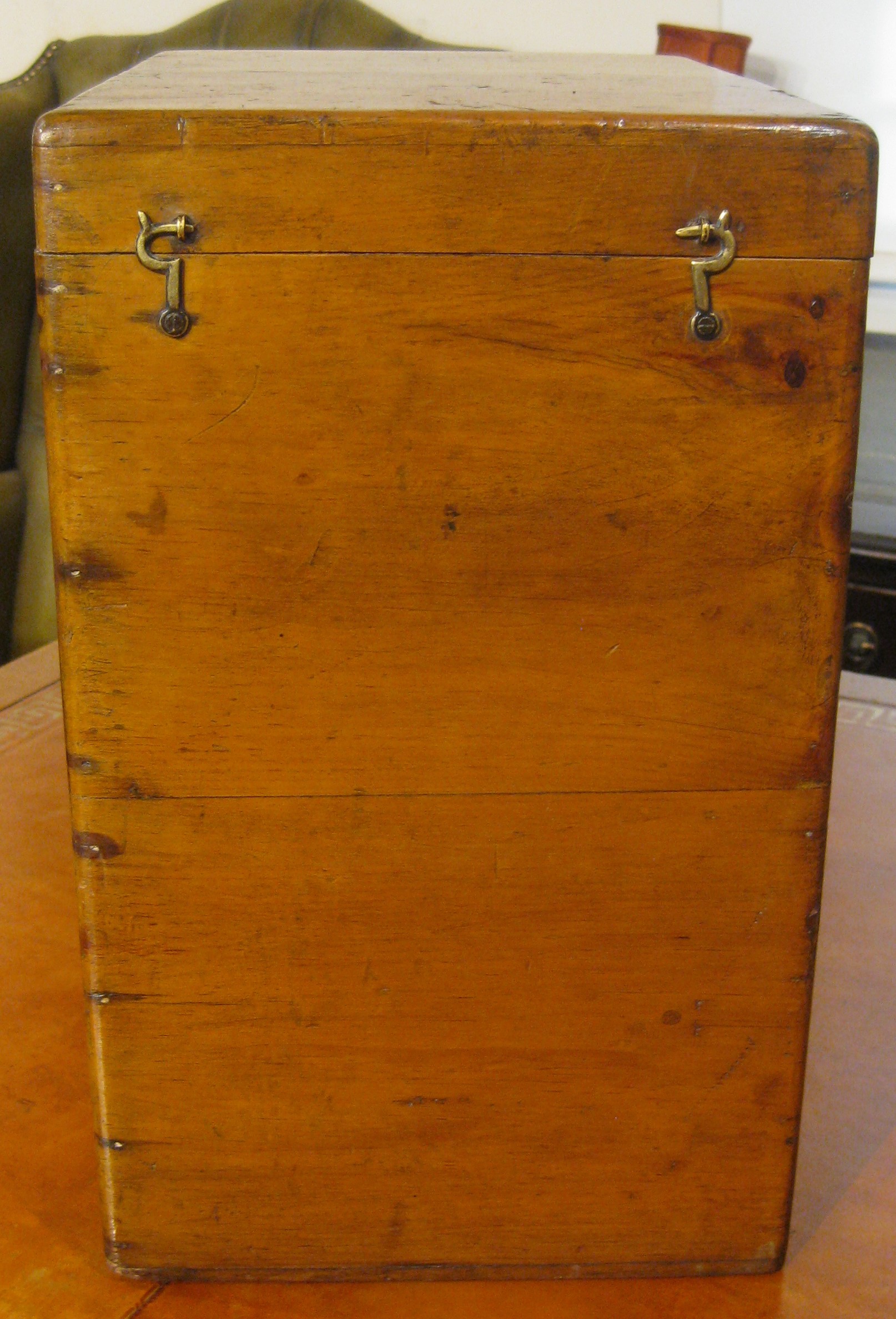
Edwardian pine box for glass slides containing just one slide of a King (?)
Size 8 x 11 x 13 inches tall (20 x 29 x 32 cm tall)
Price £60
Stock no. 6064
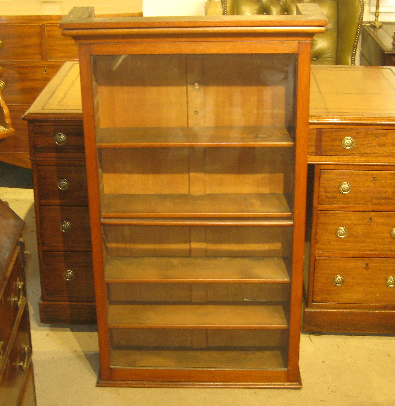
Victorian mahogany bookcase. The glazed door enclosing 4 adjustable shelves. Originally a hanging bookcase but can be free standing.
Size 28 x 9 x 45 inches tall (70 x 24 x 114 cm tall)
Price £185
Stock no. 6057
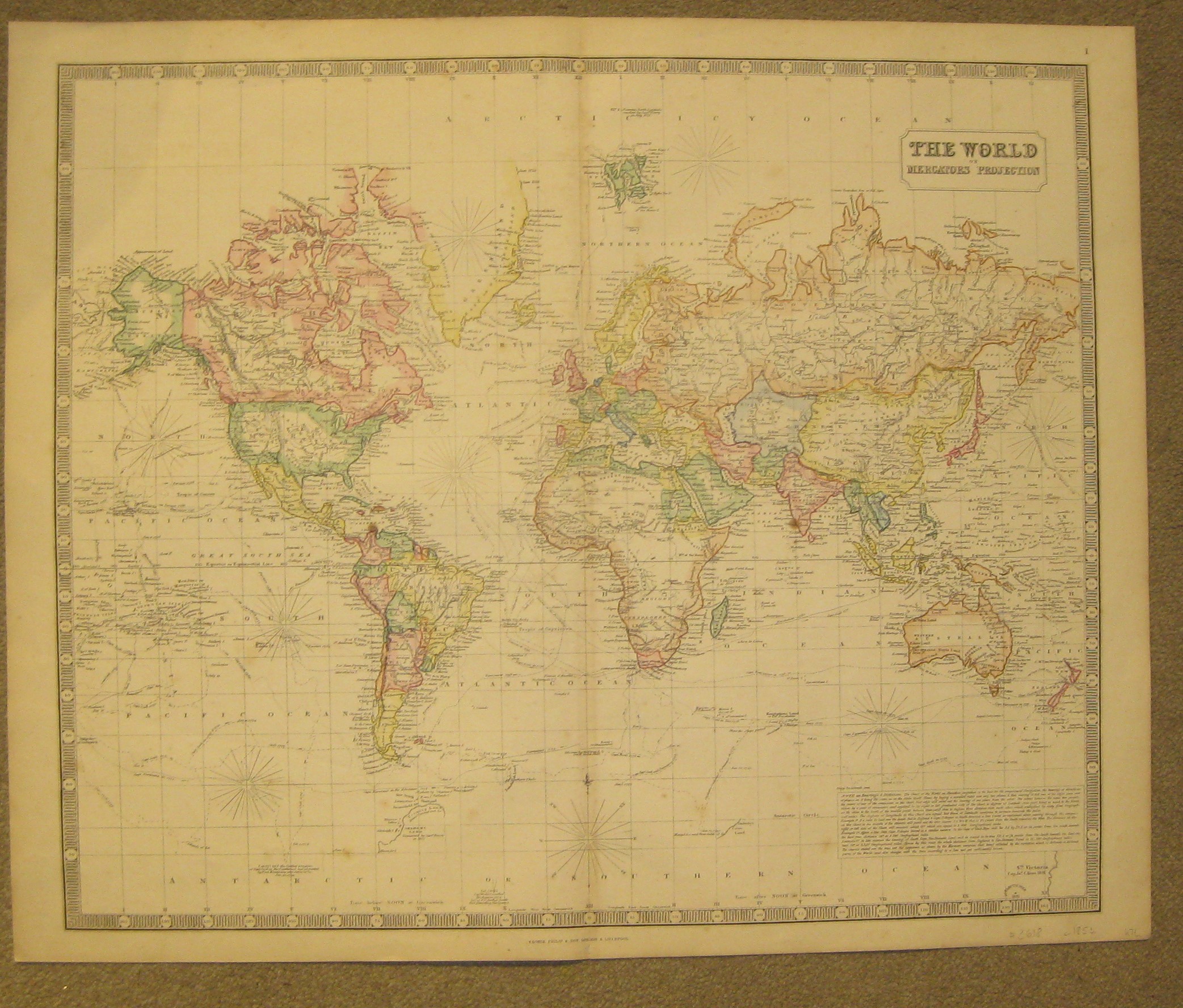
A beautiful map of the World on Mercator’s Projection from George Philip’s ‘Imperial General Atlas’. Very detailed map stating shipping routes of various explorers. Showing plenty of ‘pink bits’ of the Empire
Lithographed map with old colouring, overall 54 x 66 cm, image 50 x 61 cm, fold as issued, slightly browned, some foxing, small split in lower centrefold not affecting image, otherwise very good condition. Verso blank.
George Philip & Son London & Liverpool c1853
Size 67 x 55 cm
Price £375
Stock no. 6055
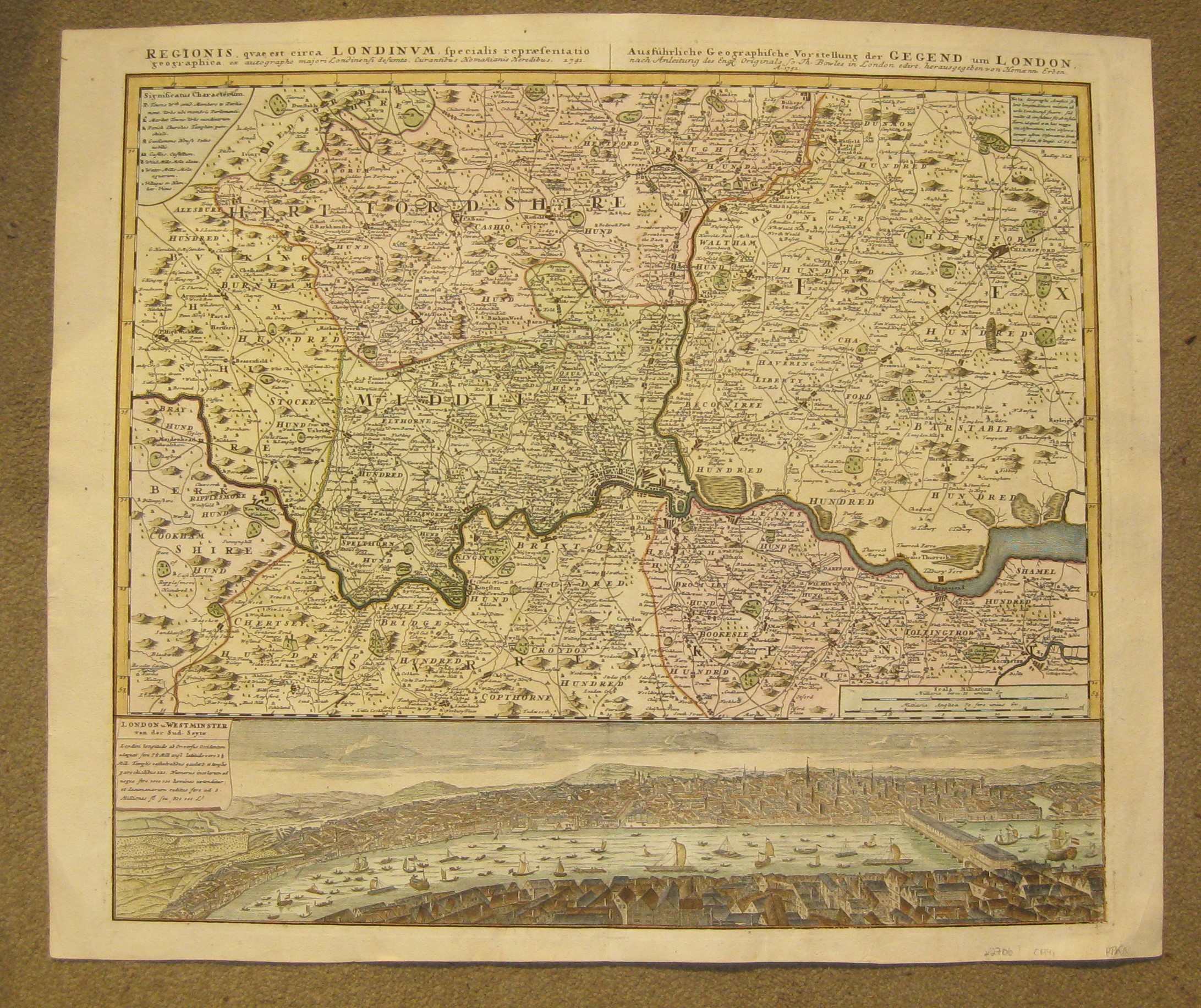
Superb and very detailed original copper engraved map of the area around London. Original copper engraved map; plate size 51 x 57 cm.
Homann Heirs (fl. from 1730) Regionis quae est circa Londinum…. Nurnberg 1741
From Hertfordshire to Surrey, and Berkshire to Essex. With a beautiful panorama view of London. Fold as issued; paper evenly toned; plate slightly rubbed in places; hand written annotation on verso; o/w vg cond.
Price £900
Size 63 x 54 cm
Stock no. 6054
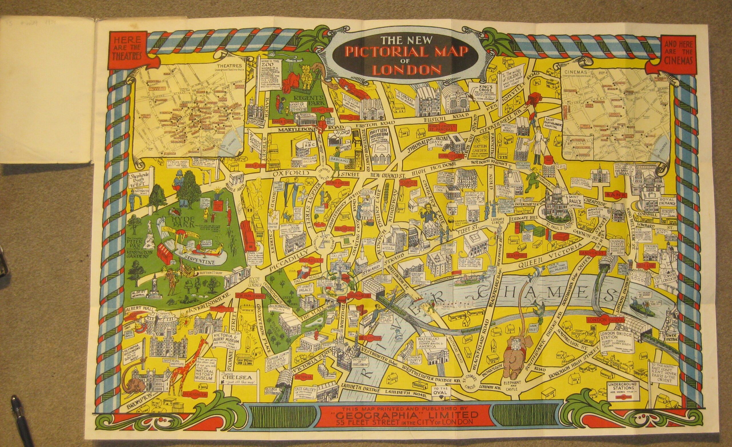
A very charming The New Pictorial Map of London.
Geographia Ltd London 1934
Colour printed paper. paper cover 17,5 x 11 cm; some wear and tear. Folds as issued; pasted on linen; some printer’s creases; o/w exc. cond.
A very charming and fun pictorial map of London in the style of Leslie MacDonald Gill’s Wonderground, from Regent’s Park to Elephant & Castle, and Hyde Park to Tower of London. There are two insets in the the top corners: ‘Here are the Theatres’ and ‘Here are the Cinemas’.
Loads of humorous depictions: who knew that ‘For More Cheap China’ you have to go to the Victoria and Albert Museum? Or that you can travel from Victoria ‘to Clapham Junction, the sunny south and the Continent? Or Hatton Gardens – ‘where Diamonds grow on Trees’?
NB: in the earlier edition of 1930, the decorative border and the two inset maps are missing.
Size open 73 x 49 cm closed 18 x 11 cm
Price £700
Stock no. 6053

A charming pocket map of London, drawn and engraved by John Archer for John Gilbert and published by George Philip & Son. The map extends from Highbury Park, Islington to Camberwell, Hyde Park to East India Docks.
Archer, John Gilbert’s New Map of London for 1851. – New Plan of London from Actual Survey,…
George Philip & Son Liverpool 1851
Steel engraved folding map with original hand colouring, overall 30 x 47 cm, 10 segments, on cloth. some wear and tear, some dusting and soiling, o/w vg cond. paper cover with pasted title, overall 15 x 11 cm, some wear and tear, o/w g cond. pasted in ‘ Abstract of the Act for Regulating Hackney Carriages and Metropolitan Stage Carriages.
Size open 47 x 31 cm, closed 16 x 11 cm
Price £350
Stock no. 6052
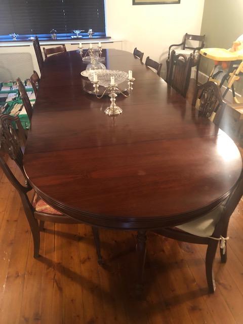
Good quality reproduction mahogany extending dining table to seat up to 14. With well turned column pedestal and fold down leg supports for additional 3 leaves. Some matching dining chairs also available.
Size 48″ circular extending with leaves up to 146 inches x 30 inches tall (126 circle up to 370 cm long x 76 cm tall)
Price £575
Stock no. 6050

Early Georgian mahogany Pembroke table, Circa 1820.
Having drop flap ends and gate leg action which supports them when opened. With single drawer and a well turned central column and four splay legs. Selling before restoration
Size 41 x 22 extending to 43 inches when open x 27 inches tall (105 x 56 extending to 110 x 69 cm tall)
Price £70
Stock no. 6049